BPI Co. has been using GIS for 7 years in managing the port infrastructure
17 Ноември 2021
For a ninth year in a row, experts from the Bulgarian Ports Infrastructure Company (BPI Co.) join the celebration of the global GIS Day as full members of the global GIS Community. For seven years now, BPI Co. has been using a Geographic Information System (GIS) for the management of the port infrastructure, as the development of the system commenced in 2013, and in 2014 it had already been implemented.
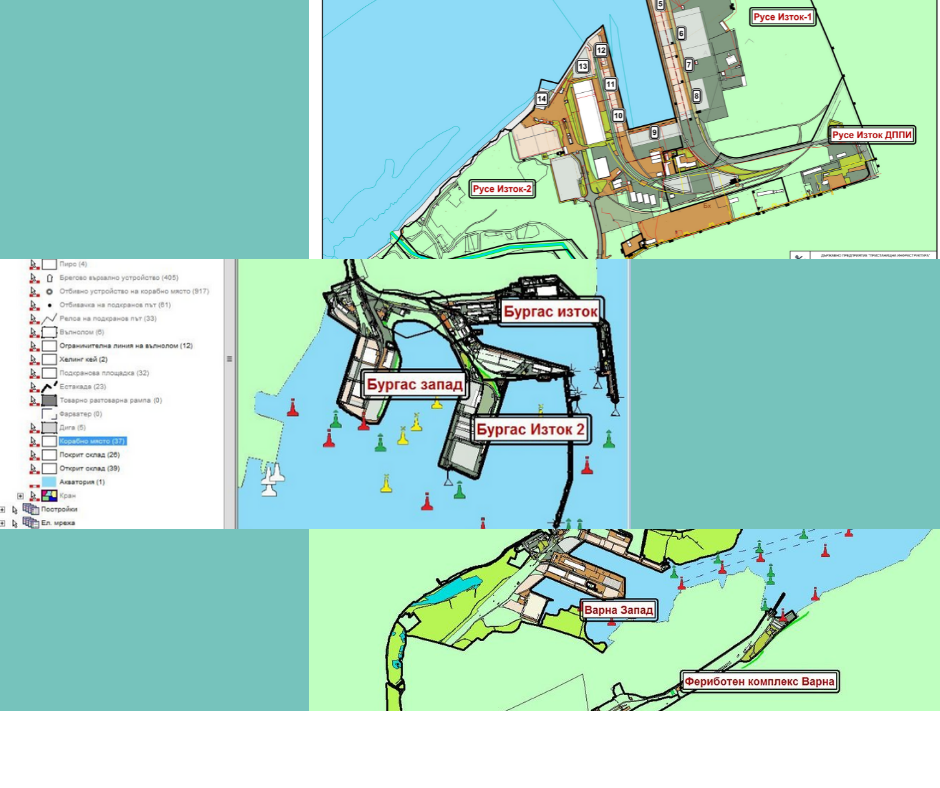
BPI Co.’s GIS stores spatial and attribute data on the terminals of the government-owned public transport ports. There is information, regarding areas, buildings, outdoor and indoor warehouses, equipment, road and railroad networks, navigation service equipment, waters, controlled by the port, etc.
Through the cartography and spatial analysis and reports functions, the GIS established itself as a valuable tool for the BPI Co., both for the inventory-taking and maintenance of the available infrastructure, and for decision-making, related to future investment plans and projects.
The data in the system are allocated in 14 categories, as each of them contains a set of spatial layers for the individual types of equipment and facilities and the relative information about them. The total number of layers in the system exceeds 140. Apart from the spatial information on the engineering and communication networks, each item also contains attributes with technical data.
The International GIS Day was first celebrated in 1999 during the Global Geography Week. Ever since, more than 700 events are organized in over 74 countries on the third Wednesday of November each year. The International GIS Day is not merely an event, but a global movement, bringing together universities, governmental institutions, schools, NGOs and professionals from all over the world, united by the eagerness to promote public awareness of the application of the GIS in the world that we live in.